I missed Drew Lerners presentation today. Whats his forecast for this season?
Announcement
Collapse
No announcement yet.
Drew Lerner forecast
Collapse
Logging in...
Welcome to Agriville! You need to login to post messages in the Agriville chat forums. Please login below.
X
-
Tags: None
-
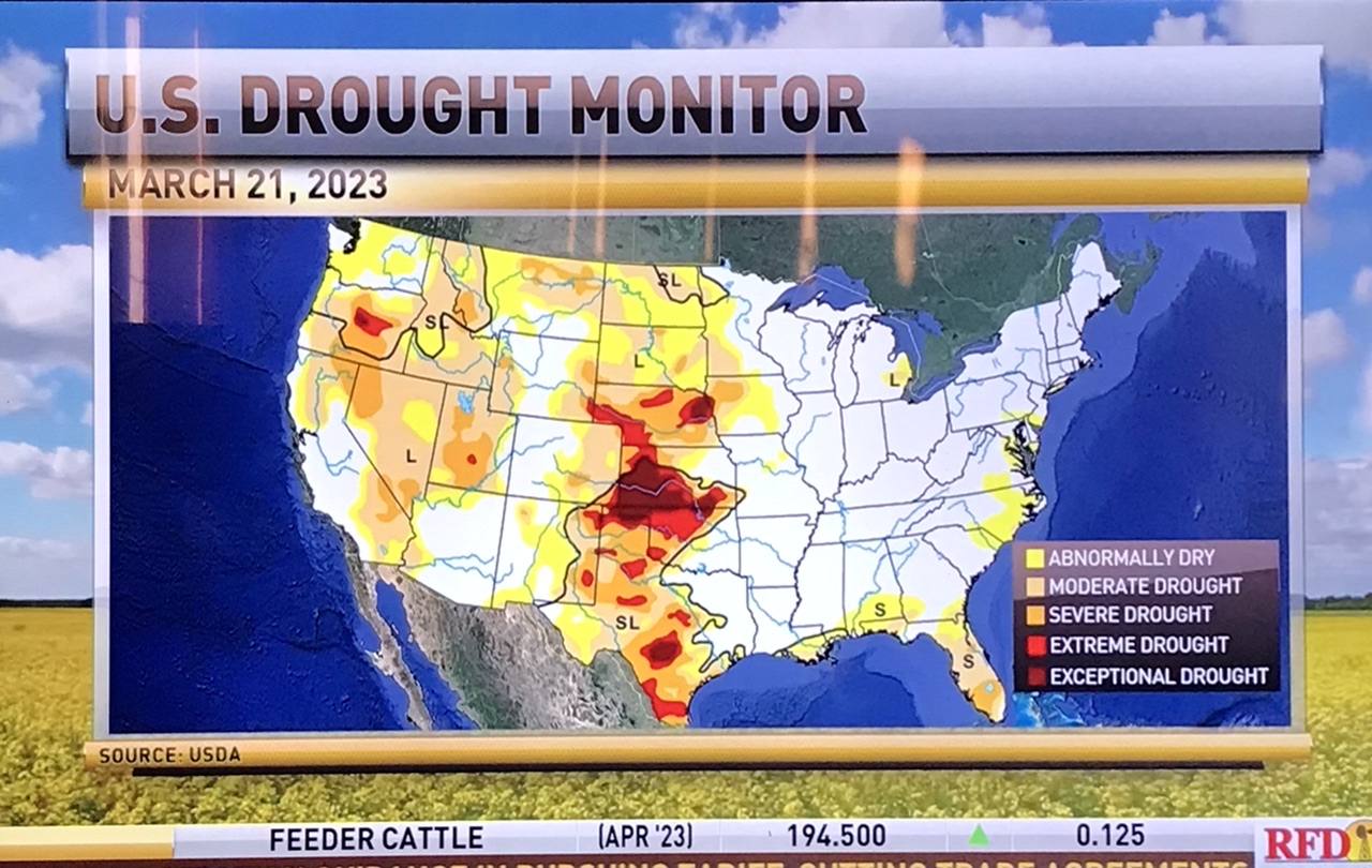
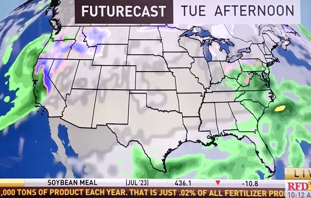
Winter snowfall and a few spring rains should provide sufficient soil moisture for seeding over much of Saskatchewan, but there will be a drier bias over southwest Saskatchewan this spring—according to Drew Lerner, a well-known agricultural meteorologist based in the United States.
Lerner spoke to farmers during a one-hour webinar sponsored by the Saskatchewan Wheat Development Commission.
Among the highlights:
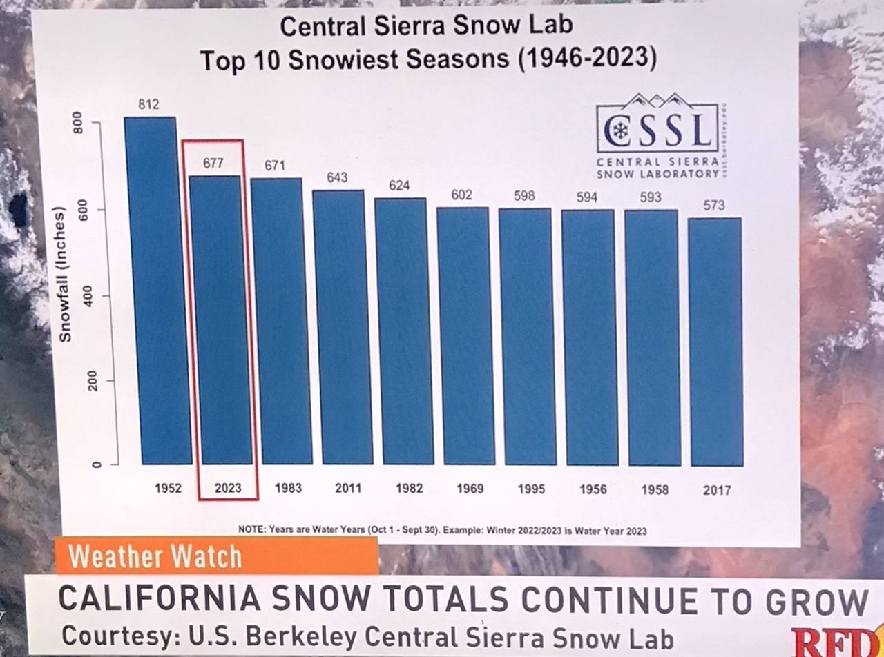
-snowfall should take the edge off last fall’s dry topsoil conditions over much of eastern Saskatchewan and the northern forest fringe
-April and May will be drier than normal in the Palliser Triangle (southwest Saskatchewan and southeast Alberta) following another winter of disappointing snow cover
-a high pressure ridge should result in better than normal summer precipitation in a band running across Saskatchewan. The location of that band will depend on the strength and location of that high pressure ridge.
-after two or three years of optimum harvest conditions, many areas could have more unsettled weather during combining.
-three years of La Nina is now over and is being replaced by a neutral phase.
-El Nino will be making a return—Lerner believes it will be in the fall or early winter.
Here is an excerpt from Lerner’s presentation on Tuesday, March 21st. (He refers to negative PDO which is Pacific Decodal Oscilliation, which is a robust, recurring pattern of ocean-atmosphere climate variability centered over the mid-latitude Pacific basin)
Comment
-
True, but why not extend it by preparing to go there to learn their language in the 7-8 weeks.Originally posted by jazz View PostMight as well head to mexico for a few weeks. Wont be turning a wheel here for 7-8 weeks.
Mexico wants your kind, so pass their entry qualifications of language, have enough wealth to cover your expenses so you will never burden their society, buy a place within a 900 unit complex that will give you ten years of use. At the end of ten years when all the cost of the build is recovered from you, you will be removed as this complex will be turned over for the real Mexican population. You have the wealth to repeat the process for the next ten years, if you haven't earthy timed yourself out.
A Mexican passport opportunity waits for you Jazz. Go for it.
Comment
-
EC has revised our forecast a lot colder for the next week.
Sunday night -25
Monday high -10
Nothing above 0
Normal here +1 and -10
March was below normal most every day.Last edited by shtferbrains; Mar 23, 2023, 07:42.
Comment
-
Grain companies and the entire trade must know something we don’t with long range weather.
Prices are plummeting so must be wet yr ahead.
Everything is on new crop production and acres.
Get tired of hearing prices are above historic levels.
So is machinery, and all inputs.
Comment
-
Thank-You Sodbuster
Originally posted by Sodbuster View PostWinter snowfall and a few spring rains should provide sufficient soil moisture for seeding over much of Saskatchewan, but there will be a drier bias over southwest Saskatchewan this spring—according to Drew Lerner, a well-known agricultural meteorologist based in the United States.
Lerner spoke to farmers during a one-hour webinar sponsored by the Saskatchewan Wheat Development Commission.
Among the highlights:
-snowfall should take the edge off last fall’s dry topsoil conditions over much of eastern Saskatchewan and the northern forest fringe
-April and May will be drier than normal in the Palliser Triangle (southwest Saskatchewan and southeast Alberta) following another winter of disappointing snow cover
-a high pressure ridge should result in better than normal summer precipitation in a band running across Saskatchewan. The location of that band will depend on the strength and location of that high pressure ridge.
-after two or three years of optimum harvest conditions, many areas could have more unsettled weather during combining.
-three years of La Nina is now over and is being replaced by a neutral phase.
-El Nino will be making a return—Lerner believes it will be in the fall or early winter.
Here is an excerpt from Lerner’s presentation on Tuesday, March 21st. (He refers to negative PDO which is Pacific Decodal Oscilliation, which is a robust, recurring pattern of ocean-atmosphere climate variability centered over the mid-latitude Pacific basin)
[ATTACH]12222[/ATTACH]
Comment
- Reply to this Thread
- Return to Topic List


Comment